Style | StandardCards

OpenStreetMap Blogs

Wednesday, 15. May 2024

OpenStreetMap User's Diaries

OSM-NG Development Diary #7 is Almost Ready

This one will be a very special one! I am working hard on finishing a big functionality and need probably 1 more day. You will be amazed of what progress has been done this week. 😎♨

This one will be a very special one! I am working hard on finishing a big functionality and need probably 1 more day. You will be amazed of what progress has been done this week. 😎♨


关于规范移动互联网应用程序中登载使用地图行为的通知

本文是中华人民共和国相关部门的法规政策,仅供读者参考。

来源:gi.mnr.gov.cn/202405/t20240511_2844891.html www.gov.cn/zhengce/zhengceku/202405/content_6950568.htm

自然资源部办公厅 工业和信息化部办公厅

关于规范移动互联网应用程序中登载使用地图行为的通知

自然资办函〔2024〕972号

各省、自治区、直辖市自然资源主管部门、电信主管部门,移动互联网应用程序主办者:

近年来,地图以其立体直观、耦合作用显著等特点,不断应用到移动互联网应用程序(以下简称APP)中,在推动经济社会高质量发展、服务百姓生活等方面作用日益凸显。为规范APP登载使用地图行为,进一步提升APP的直观性、交互性、动态性,现将有关

本文是中华人民共和国相关部门的法规政策,仅供读者参考。

来源:https://gi.mnr.gov.cn/202405/t20240511_2844891.html https://www.gov.cn/zhengce/zhengceku/202405/content_6950568.htm

自然资源部办公厅 工业和信息化部办公厅

关于规范移动互联网应用程序中登载使用地图行为的通知

自然资办函〔2024〕972号

各省、自治区、直辖市自然资源主管部门、电信主管部门,移动互联网应用程序主办者:

近年来,地图以其立体直观、耦合作用显著等特点,不断应用到移动互联网应用程序(以下简称APP)中,在推动经济社会高质量发展、服务百姓生活等方面作用日益凸显。为规范APP登载使用地图行为,进一步提升APP的直观性、交互性、动态性,现将有关事项通知如下:

一、提高政治站位

正确的国家版图是国家主权和领土完整的象征,体现了国家在主权方面的意志和在国际社会中的政治、外交立场。地图是国家版图最常见、最直观的表现形式,具有严肃的政治性、严密的科学性、严格的法定性。APP中登载使用未依法履行地图审核程序的“问题地图”,错绘我国国界线、漏绘我国重要岛屿,甚至标注涉军涉密敏感信息,将严重损害我国国家主权、安全和发展利益。各地、各有关单位、各移动互联网应用程序主办者要坚持总体国家安全观,充分认识正确登载使用地图的重要性,增强国家版图意识,坚决防止“问题地图”的产生。

二、规范相关行为

(一)依法履行行政审批。从事互联网地图服务的APP主办者应按照《中华人民共和国测绘法》《中华人民共和国反电信网络诈骗法》《互联网信息服务管理办法》《地图管理条例》等规定,向自然资源主管部门、电信主管部门履行地图审核程序、ICP备案手续。地图内容发生变化或者进行更新的,应依法重新履行地图审核程序。

(二)严格落实主体责任。APP主办者应落实安全主体责任,确保在登载使用地图时准确反映中国领土范围、行政区域界线、重要岛屿等并标示审图号;引用地图时要注明地图来源和审图号;对违反法律法规登载使用地图的注册用户要依法依约采取警示、限制功能、关闭账号、保存记录并上报等处置措施。从事互联网地图服务的APP主办者,还应持续强化技术能力建设,加强对互联网地图新增内容的核查校对。

(三)强化国家版图意识宣传。APP主办者应按照自然资源主管部门、电信主管部门要求,积极参与国家版图意识宣传工作,知悉了解地图管理相关法律法规,牢固树立“地图无小事”的观念,在APP开发、上线审查阶段明确规范使用地图的要求,从源头上防止“问题地图”的出现,以实际行动维护国家主权、安全。

三、增强协同联动

(一)优化服务。各地自然资源主管部门、电信主管部门要优化地图审核、APP备案政务服务,提供信息化服务等便利措施,提高工作效率。各地自然资源主管部门要加大标准地图投放力度,继续通过标准地图服务系统bzdt.ch.mnr.gov.cn以及国家地理信息公共服务平台“天地图”bzdt.ch.mnr.gov.cn向社会公众免费提供标准地图和具有审图号的地图,不断满足社会公众、法人主体对地图的需求。

(二)建立机制。各地自然资源主管部门、电信主管部门应建立信息共享、应急处理、联合惩戒等工作机制,形成工作合力。两部门定期通报有关地图审核信息及APP备案信息,对梳理发现的APP中的“问题地图”线索进行会商,对重点违规线索开展深入调查,对可能出现的问题进行预判,对趋势性问题提出措施,提高防范“问题地图”和抵御风险的能力,督促APP主办者落实安全管理责任义务。

(三)加强监管。针对登载使用地图的APP存在“应当送审而未送审的,使用未经依法审核批准的地图提供服务的,或者未对互联网地图新增内容进行核查校对的,通过互联网上传标注了含有按照国家有关规定在地图上不得表示的内容的,未在地图的适当位置显著标注审图号的”等违法违规行为,自然资源主管部门将会同电信主管部门对APP主办者依法采取处置措施,营造规范健康的互联网地图服务市场环境。

自然资源部办公厅 工业和信息化部办公厅

2024年4月24日

Tuesday, 14. May 2024

OpenStreetMap User's Diaries

SURVEY UPDATE: Women Participation in OpenStreetMap: Perspectives of all Genders

In March 2023, I conducted a survey on women’s participation in OSM activities. It became apparent that individuals’ perspectives came into place and interpreted the survey topic differently. The survey aimed to gather perceptions, opinions, and insights into why some women do not participate in OSM activities and what factors may discourage those who were already participating from continuing.

In March 2023, I conducted a survey on women’s participation in OSM activities. It became apparent that individuals’ perspectives came into place and interpreted the survey topic differently. The survey aimed to gather perceptions, opinions, and insights into why some women do not participate in OSM activities and what factors may discourage those who were already participating from continuing. There were various reactions about the survey, from questioning the relevance of the topic to commending the effort to address it.

I was fortunate to have had support from various individuals for the topic, including Heather Leson, Arnalie Vicario, Pete Masters, Geoffrey Kateregga, and the Geochicas family, who were interested and open to exploring the topic through webinars and discussions. One such webinar featured speakers from diverse backgrounds:

  • Stellamaris Wavamunno Nakacwa, Programme Director at Youthmappers EverywhereSheMaps
  • Mikko Tamura, Community Manager at Open Mapping Hub Asia Pacific
  • Jaqueline Amorim, Expert Mapper in Geostatical Data/HOT Data Quality Intern in 2022

The webinar was moderated by Dr. Prince Kwame Odame from Africa, a lecturer at the University of Education Winneba-Ghana. You can review the webinar here.

A unique aspect of the survey was that, in addition to focusing on individuals who identify as women, I also sought perspectives from men. I was pleasantly surprised by some of their positive viewpoints, although there were also negative responses. I am grateful to everyone who took the time to participate in the survey.

One key takeaway from the survey is the importance of considering diverse perspectives. Just because something may not be perceived as an issue by one person does not mean it isn’t significant to others. We all view the world through different lenses, and it’s essential to be considerate and open-minded to learn from various angles.

I appreciate your patience, and below is the summary of the survey and the full report can be read here.

Thank you all for your understanding and support.

Survey Inforgraph

Survey Inforgraph

Survey Inforgraph

Survey Inforgraph

Survey Inforgraph


Hydrantenplan

Zusammenfassung

Hydrantenplanerstellung Freiwillige Feuerwehr Holenbrunn. Ziel war eine lauffähige kostenfreie Lösung zu erzeugen

  • die es gibt den “eigenen” Hydrantenplan zu erstellen (Papier/ für Hydrantenschau).
  • beim Einsatz auch ortsfremden Wehren, das Finden des “besten” Hydranten zu ermöglichen.

Anderen Wehren die Möglichkeiten aufzuzeigen, Vorgehens

Zusammenfassung

Hydrantenplanerstellung Freiwillige Feuerwehr Holenbrunn. Ziel war eine lauffähige kostenfreie Lösung zu erzeugen

  • die es gibt den “eigenen” Hydrantenplan zu erstellen (Papier/ für Hydrantenschau).
  • beim Einsatz auch ortsfremden Wehren, das Finden des “besten” Hydranten zu ermöglichen.

Anderen Wehren die Möglichkeiten aufzuzeigen, Vorgehensweisen weiterzugeben (diese Doku).

Eine umfassendere Info findet sich bei https://feuerwehr-grossmehring.de/cms/images/stories/Dokumente/openfiremap_anleitung.pdf

Ziel

  • Aufnehmen der Hydranten
  • Erstellen von Lageplan für Hydrantenschau
  • Hydranten per Handy-App im Einsatz auffindbar machen
  • Keine Kosten (Verwendung von Open Source)
  • Zugang ohne sich auf Lieferanten / Dienstleister zu stützen
  • Zugang für Viele
  • Kein(e) Wartungsaufwand / -kosten

Out of Scope

  • Leitungspläne
  • Koordinaten-genaue Eintragung (nicht möglich Messungenauigkeit / Kartenmaterial)
  • RefernezID Stadt eintragen
  • 100% Erfassung (kann sein das Hydranten übersehen wurden)

Ergebnis:


Vorgehensweise Holenbrunn - Wie Hydranten aufnehmen

Setup das Verwendet wurde

Tablet mit Mobile Hotspot. Aufnahme wird bestimmt auch anders gehen. Das hier Beschriebene, war das Setup, dass gerade zur Hand war. Andere Möglichkeiten siehe OSM Info wie man Hydrandten aufnimmt Blueprint )

Wie aufnehmen? [Lösung hier]

Einzelkämpfer per Fahrrad an mehreren WE Umgebung abfahren (~ 5km/h mit Aufnehmen der Hydranten).

[bessere Lösungen / E

Setup das Verwendet wurde

Tablet mit Mobile Hotspot. Aufnahme wird bestimmt auch anders gehen. Das hier Beschriebene, war das Setup, dass gerade zur Hand war. Andere Möglichkeiten siehe OSM Info wie man Hydrandten aufnimmt Blueprint )

Wie aufnehmen? [Lösung hier]

Einzelkämpfer per Fahrrad an mehreren WE Umgebung abfahren (~ 5km/h mit Aufnehmen der Hydranten).

[bessere Lösungen / Ergänzung um bessere Datenqualität zu erreichen:

  • Jugendfeuerwehr Aktionstag
  • Altvordere die alle Hydranten persönlich kennen, befragen (mit Vorgefüllter Karte)
  • Bei Hydrantenschau mit anlegen (online/ offline alles möglich)
  • Uvm …

Hydranten aufnehmen (genutzte Systeme)

Voraussetzungen:

  1. Openstreetmap(OSM) Account erstellen [Kartenmaterial Grundlage] -> https://www.openstreetmap.org/
  2. OSMHydrant zum entspannten Eintragen [Feuerwehr orientierte Eingabe, Hydranten, Position] OSM Account ist Voraussetzung-> https://www.osmhydrant.org/de/
  3. OpenFireMap Übersichtliche Anzeige auf Desktop http://www.openfiremap.de
  4. OSMAND Handy Applikation https://osmand.net

Vorgehen Eintragen (Schrittbeschreibung) [Gibt auch die Bebilderte Vollversion die ich leider hier nicht abbilden kann]

  1. Finde den Hydranten
  2. Position merken (Zettel/Karte/Kopf, wenn Foto dann auch Schild)

    • Oberflur Hydrant (idealerweise BBA, BB oder CCB)

    • Unterflur Hydrant (Nur aufnehmen, wenn Schild … oder man kennt den Hydranten)

    • Löschwasserstelle (Nur mit Schild)

    • Löschwasserbehälter (Wenn möglich mit m³)

  3. OSMHydrant eintragen Mögliche Typen a. Hydrant
    b. Löschwasserstelle
    c. Löschwasserbehälter

  4. Position einzeichnen

  5. Speichern drücken

  6. Angaben eingeben

    6.1 Überflur-Hydrant -> mindestens ○ Datum ○ Art ○ Wasserquelle ○ Position

    6.2. Unterflur Hydrant mindestens a. Art b. Wasserquelle c. Position d. Durchmesser

    6.3. Löschwasserstelle a. Wenn notwendig Hinweise

    6.4. Wassertank a. Volumen m³

  7. Eingabe Speichern.
  8. OSMHydrant zeigt jetzt Eintagungen an
  9. Hier kann auch geändert werden //Vorgehen -> Wie in Karte sehen?
  10. Warten das Daten aus OSMHydrant in Openfiremap übernommen werden (Dienstag Upload-Tag … kann aber auch 2 Wochen dauern).

Handy als Anzeigegerät - Die offline-fähige Lösung

Vorgehen -> Wie auf Handy sehen?
  1. OSMAnd Google Play runterladen (es wird nur die kostenlose Basisversion gebraucht)
  2. Karten laden (Bayern etc. ) -> Offline Kartenmaterial (Begrenzete Anzahl von Uploads, idealerweise reicht einer am Ende der Kartierungskampangne)
  3. Menü -> Karte Konfigurieren -> Overlay Karte -> FireHydrant [Rote Hydranten Symbol

Vorgehen -> Wie auf Handy sehen?

  1. OSMAnd Google Play runterladen (es wird nur die kostenlose Basisversion gebraucht)
  2. Karten laden (Bayern etc. ) -> Offline Kartenmaterial (Begrenzete Anzahl von Uploads, idealerweise reicht einer am Ende der Kartierungskampangne)
  3. Menü -> Karte Konfigurieren -> Overlay Karte -> FireHydrant [Rote Hydranten Symbole]
    -> online Update & -> bleibt dann offline da -> Mit Schieber kann zwischen Hydranten Position & Kartenbeschriftung gewechselt werden (bessere Übersichtlichkeit wenn man das Gebiet nicht kennt und Orts-/ Strassen-Namen/-Nummern braucht )

  4. [Nicht benutzt da unübersichtlich] Karte konfigurieren -> POI … Hydrant [Gelbe Hydranten Symbole] (Kommt wohl nur mit Offline KartenUpdate mit)

Ausdrucke HydrantenPlan

Ausgabe der Karten als Datei zum Ausdrucken (SVGZ Ist Vektor-Format das ohne Qualitätsverluste skalierbar ist)

print.get-map.org/maps/333166/VXZIvtuKflvuMRPP#submitmapform print.get-map.org/maps/

Ausgabe der Karten als Datei zum Ausdrucken (SVGZ Ist Vektor-Format das ohne Qualitätsverluste skalierbar ist)

https://print.get-map.org/maps/333166/VXZIvtuKflvuMRPP#submitmapform https://print.get-map.org/maps/


Karten Infos

wiki.openstreetmap.org/wiki/DE:OpenFireMap#Papier_/_Grafik

Tool um Lagepläne für Hydrantenschau UFH zu erstellen
overpass-turbo.eu/

[Skript]

/* Skript das bereits alle Typen enthält. Einstellung per Kommentar hinzu/entfernen gib die Karten/Punktelisten(alsXLS) aus.

This has been generated by the overpass-turbo wizard. The original search was: “emergency=fire_hydrant

https://wiki.openstreetmap.org/wiki/DE:OpenFireMap#Papier_/_Grafik

Tool um Lagepläne für Hydrantenschau UFH zu erstellen
http://overpass-turbo.eu/

[Skript]

/* Skript das bereits alle Typen enthält. Einstellung per Kommentar hinzu/entfernen gib die Karten/Punktelisten(alsXLS) aus.

This has been generated by the overpass-turbo wizard. The original search was: “emergency=fire_hydrant and (fire_hydrant:type=underground or fire_hydrant:type=pillar)” */ [out:json][timeout:25]; // gather results (

nwr[“emergency”=”fire_hydrant”] ({{bbox}}); // Alle Hydranten

// nwr[“emergency”=”fire_hydrant”]“fire_hydrant:type”=”underground”; // Unterflur Hydranten

// nwr[“emergency”=”fire_hydrant”]“fire_hydrant:type”=”pillar”; // Oberflur Hydranten

// nwr“emergency”=”water_tank”; // Löschwasserbehälter

// nwr“emergency”=”suction_point”; // Löschwasserentnahmestellen

); // print results out geom;

[/Skript]

Dann in Excel aufmachen, & sortieren (XML / maniueller Editor-/ xls-Magic daten rauspulen) Unterflurhydranten [Bild] / [Liste]


Nomenklatur Vorschlag

Vorschlag Hydrant

ReferenzCode / Eigenname wird unterschiedlich gepflegt.

Hier mein Vorschlag, der sowohl Bauhof als auch lokale FFW glücklich macht.

(Habe keinen Kontakt zu Stadt/Bauhof) Sollte eine interne Sadbauhof-Nummern zur Wartung dranflanscht werden, ist Reference-Code der zu nutzende Eintrag.

Der hier vorgeschlagene Eigenname ist so aufgebaut, das die FFW die In

Vorschlag Hydrant

ReferenzCode / Eigenname wird unterschiedlich gepflegt.

Hier mein Vorschlag, der sowohl Bauhof als auch lokale FFW glücklich macht.

(Habe keinen Kontakt zu Stadt/Bauhof) Sollte eine interne Sadbauhof-Nummern zur Wartung dranflanscht werden, ist Reference-Code der zu nutzende Eintrag.

Der hier vorgeschlagene Eigenname ist so aufgebaut, das die FFW die Info zur Hydrantenschau verwenden kann (z.B. wenn mehrere Gruppen parallel, in definierten Gebieten, mit Halbwissen unterwegs sind (Liste, Nächste Adresse -> erspart Nacharbeit) ).

Referenz Code:

[StadtwerkeID] Möglichkeit bei Hydrantenaschau direkt mit Bauhof “sprechen” zu können

Eigenname:

[ART][LeitungDN][nächsteAddresse] Mit etwas OSM_Wissen, XML editieren & XLS Magic, können Hydrantenlisten erstellt werden.

Beispiel Eigenname: “UFH DN150 Bahnhofsstrasse2a”

Karten Infos

  • UFH DN150 Bahnhofsstrasse2a
  • UFH UnterflurHydrant
  • OFH OberflurHydrant
  • DN??? Durchmesser Speiseleitung
  • StrasseNummer [Straße ausschreiben ohne Leerzeichen Nummer dahinter]

OpenCage

Field Mapping - a report from Bangalore

A guest post from our firned Tushar about a mapping party in Bangalore

Hi everyone,

today I’m very happy to share a special guest post from Tushar V, who last weekend attended his first ever OpenStreetMap mapping party in Bangalore, India. Tushar is the son of a long-time former colleague / friend / advisor of OpenCage who lives in Bangalore, this was Tushar’s first mapping party. We thought it would be interesting for everyone to read and see how a mapping party works, but also why OpenStreetMap is such an interesting hobby for young and old.

Many thanks to the organizers of the party, everyone who attended and mapped. We are very pleased to welcome Tushar to the OpenStreetMap community!

Now over to Tushar …

OSM Mapping Party Bangalore - It’s fun!

On 12th May 2023, I attended an OpenStreetMap “Mapping Party” in Bangalore. What is a mapping party? A mapping party is an event hosted by OSM enthusiasts who come together to contribute to the vast data of OSM by mapping all surrounding areas near a fixed location. This was my first time attending a mapping party and I had no experience in mapping but I still went anyway to see what I could learn.

"The group meets to start the mapping party"

The party started at one corner of Sankey Tank in Malleshwaram, Bangalore, and participants had to proceed south and map areas mainly along the two parallel roads running almost a kilometre: “Sampige Road” and “Margosa Road” (see on OpenStreetMap) which also have multiple roads intersecting them. The state of the map in the area was fairly good. There were hardly any roads or residential areas missing, but there was a large number of shops, banks, ATMs, temples and other structures that were yet to be mapped.

"Let the mapping begin!"

The event was organised by two OSM enthusiasts: Vivek and Arjun. There were ten mappers and most of them were from software, data and geospatial backgrounds, but I soon learned that you don’t have to be a software engineer or cartographer to map the area (at least as long as you are only concerned about field mapping). The first-timers were introduced and given a quick training in an app called “Every Door” which is so simple that it can be used by a 13-year-old; the app lets you map anything from a tree to a bank to even a road using your smartphone.

"Mapping"

For the next twp hours, all mappers spent the time mapping important features that were missing on the map. Once I got the hang of it, I mapped some popular shops like Nandini milk booth, a few ATMs and even some major banks. At the end of the day, the group mapped over 350 features which can be seen on the map given below.

"Map of the edits produced by the mapping party"

image credit: Vivek

Reflecting, it was a pretty fun experience. I got to explore something new. I also got to meet some really friendly people and discover a whole new community of mappers I didn’t know existed.

A few recommendations from my side to anyone thinking of organizing a mapping party would be to communicate more details about the event and what is going to happen in it on social media instead of keeping the participants in the dark until the actual event.

To any first-timer who has never mapped before, my advice would be to just chill out, it will be fun and you just might learn something new.

Well done, Tushar. Great to read that you enjoyed the mapping. Keep going! But beware - OpenStreetMap can be addictive.

Happy mapping,

Ed

BTW - anyone who wants to learm more about the Every Door app will enjoy this interview with its maker, Ilya Zverev over on the Geomob podcast.


OpenStreetMap User's Diaries

내 관심지역에 붙는 '노트'를 RSS로 받아보는 방법(How to get RSS notifications of "notes" in your area of interest)

오픈스트리트맵(OSM)에 꽤 많은 노트(note)가 붙고 있지만 제대로 살펴보는 사람이 적어서 오랫동안 방치되는 일이 많습니다.
살고 있는 지역이나 관심있는 지역에 붙는 ‘노트’ 내용을 RSS로 받아볼 수 있는 방법을 적어 보고자 합니다.
RSS 받기 봇을 쓰면 OSM에서 흔히 쓰는 ‘텔레그램’에서도 그 내용을 받아 볼 수 있습니다.

방법 1
  1. 테두리 상자 선택 연장을 엽니다.
  2. Alt 키를 누른 채로 테두리를 정하는데, 한국의 경우 시·군·구 정도나 그보다 약간 넓은 정도의 영역이어야 하는 것 같습니다.(처리하기 어려울 정도로 넓은 영역을 잡으면 에러가 납니다.)
  3. 아래 쪽 항목 가운데 맨 위 ‘API, XAPI, Maperi

오픈스트리트맵(OSM)에 꽤 많은 노트(note)가 붙고 있지만 제대로 살펴보는 사람이 적어서 오랫동안 방치되는 일이 많습니다.
살고 있는 지역이나 관심있는 지역에 붙는 ‘노트’ 내용을 RSS로 받아볼 수 있는 방법을 적어 보고자 합니다.
RSS 받기 봇을 쓰면 OSM에서 흔히 쓰는 ‘텔레그램’에서도 그 내용을 받아 볼 수 있습니다.

방법 1

  1. 테두리 상자 선택 연장을 엽니다.
  2. Alt 키를 누른 채로 테두리를 정하는데, 한국의 경우 시·군·구 정도나 그보다 약간 넓은 정도의 영역이어야 하는 것 같습니다.(처리하기 어려울 정도로 넓은 영역을 잡으면 에러가 납니다.)
  3. 아래 쪽 항목 가운데 맨 위 ‘API, XAPI, Maperitive, osmconvert, osmium’ 항목의 숫자를 복사해 놓습니다.
  4. http://api.openstreetmap.org/api/0.6/notes/feed?bbox=smaller_longitude,smaller_latitude,larger_longitude,larger_latitude에서 ‘smaller_longitude,smaller_latitude,larger_longitude,larger_latitude’ 부분에 그 숫자를 붙여 넣으면 RSS 주소가 완성됩니다.
  5. RSS를 읽어들일 수 있는 곳에 그 주소를 붙여 넣으면 됩니다.

방법 2(아주 간단한 방법)

OSM QA Feeds 연장을 열고 찾고자 하는 지역을 검색해 들어간 다음 테두리 상자를 조절하면 됩니다.
이 때에도 한국의 경우 시·군·구 정도의 넓이로 잡는 것이 좋습니다.

Open the OSM QA Feeds tool, search for the region you want to find, and adjust the border box.
A good rule of thumb is to make it about the size of a county. If it’s too wide, it won’t be able to process it and will throw an error.

Monday, 13. May 2024

OpenStreetMap User's Diaries

Ideas of changes in OpenStreetMap

  1. Introduce blocks that prevent editing in selected areas, e.g. a country, an administrative unit (editing controversial objects in the field), and not the entire world. Now I can’t improve my neighborhood due to controversial editions in Ukraine.
  2. Comments on your profile should link to a page where your changeset comments are located, not to log comments.
  3. The link to
  1. Introduce blocks that prevent editing in selected areas, e.g. a country, an administrative unit (editing controversial objects in the field), and not the entire world. Now I can’t improve my neighborhood due to controversial editions in Ukraine.
  2. Comments on your profile should link to a page where your changeset comments are located, not to log comments.
  3. The link to your first edits in OpenStreetMap is intended to understand the difficulties for a beginner editor.
  4. Links to apps and websites related to OpenStreetMap from main page (with map) e.g.: MapRoulette, how did you contribute to OpenStreetMap?, osm-revert.

OSM Info wie man Hydrandten aufnimmt Blueprint Linksammlung

Sehr detaillierte Info / Anleitung (PDF) / Handbuchqualität (Grundlagen / viel weitere Ausbaustufe)

feuerwehr-grossmehring.de/cms/images/stories/Dokumente/openfiremap_anleitung.pdf

feuerwehr-grossmehring.de/cms/index.php/die-feuerwehr/hydrantenplaene

Definition der Hydranten auf OSM

wiki.openstreetmap.org/wiki/DE:OpenFireMap

Toollist

www.openstreetmap.org

Sehr detaillierte Info / Anleitung (PDF) / Handbuchqualität (Grundlagen / viel weitere Ausbaustufe)

https://feuerwehr-grossmehring.de/cms/images/stories/Dokumente/openfiremap_anleitung.pdf

https://feuerwehr-grossmehring.de/cms/index.php/die-feuerwehr/hydrantenplaene

Definition der Hydranten auf OSM

https://wiki.openstreetmap.org/wiki/DE:OpenFireMap

Toollist

https://www.openstreetmap.org Offene Karten Daten (Basis)

https://www.osmhydrant.org/de Tool zum Aufnehmen von Hydranten

http://www.openfiremap.de/ Tool zur Hydranten Übersicht

https://print.get-map.org/maps/ Tool zum Ausdruck von Karten

http://overpass-turbo.eu/ Tool zur Datenverarbeitung (Datenwolken / Karten mit Zusatzinfos


Nomenklatur Vorschlag

Vorschlag Hydrant

ReferenzCode / Eigenname wird unterschiedlich gepflegt.

Hier mein Vorschlag, der sowohl Bauhof als auch lokale FFW glücklich macht.

(Habe keinen Kontakt zu Stadt/Bauhof) Sollte eine interne Sadbauhof-Nummern zur Wartung dranflanscht werden, ist Reference-Code der zu nutzende Eintrag.

Der hier vorgeschlagene Eigenname ist so aufgebaut, das die FFW die In

Vorschlag Hydrant

ReferenzCode / Eigenname wird unterschiedlich gepflegt.

Hier mein Vorschlag, der sowohl Bauhof als auch lokale FFW glücklich macht.

(Habe keinen Kontakt zu Stadt/Bauhof) Sollte eine interne Sadbauhof-Nummern zur Wartung dranflanscht werden, ist Reference-Code der zu nutzende Eintrag.

Der hier vorgeschlagene Eigenname ist so aufgebaut, das die FFW die Info zur Hydrantenschau verwenden kann (z.B. wenn mehrere Gruppen parallel, in definierten Gebieten, mit Halbwissen unterwegs sind (Liste, Nächste Adresse -> erspart Nacharbeit) ).

Referenz Code:

[StadtwerkeID] Möglichkeit bei Hydrantenaschau direkt mit Bauhof “sprechen” zu können

Eigenname:

[ART][LeitungDN][nächsteAddresse] Mit etwas OSM_Wissen, XML editieren & XLS Magic, können Hydrantenlisten erstellt werden.

Beispiel Eigenname: “UFH DN150 Bahnhofsstrasse2a”

Karten Infos

  • UFH DN150 Bahnhofsstrasse2a
  • UFH UnterflurHydrant
  • OFH OberflurHydrant
  • DN??? Durchmesser Speiseleitung
  • StrasseNummer [Straße ausschreiben ohne Leerzeichen Nummer dahinter]

Karten Infos

wiki.openstreetmap.org/wiki/DE:OpenFireMap#Papier_/_Grafik

Tool um Lagepläne für Hydrantenschau UFH zu erstellen
overpass-turbo.eu/

[Skript]

/* Skript das bereits alle Typen enthält. Einstellung per Kommentar hinzu/entfernen gib die Karten/Punktelisten(alsXLS) aus.

This has been generated by the overpass-turbo wizard. The original search was: “emergency=fire_hydrant

https://wiki.openstreetmap.org/wiki/DE:OpenFireMap#Papier_/_Grafik

Tool um Lagepläne für Hydrantenschau UFH zu erstellen
http://overpass-turbo.eu/

[Skript]

/* Skript das bereits alle Typen enthält. Einstellung per Kommentar hinzu/entfernen gib die Karten/Punktelisten(alsXLS) aus.

This has been generated by the overpass-turbo wizard. The original search was: “emergency=fire_hydrant and (fire_hydrant:type=underground or fire_hydrant:type=pillar)” */ [out:json][timeout:25]; // gather results (

nwr[“emergency”=”fire_hydrant”] ({{bbox}}); // Alle Hydranten

// nwr[“emergency”=”fire_hydrant”]“fire_hydrant:type”=”underground”; // Unterflur Hydranten

// nwr[“emergency”=”fire_hydrant”]“fire_hydrant:type”=”pillar”; // Oberflur Hydranten

// nwr“emergency”=”water_tank”; // Löschwasserbehälter

// nwr“emergency”=”suction_point”; // Löschwasserentnahmestellen

); // print results out geom;

[/Skript]

Dann in Excel aufmachen, & sortieren (XML / maniueller Editor-/ xls-Magic daten rauspulen) Unterflurhydranten [Bild] / [Liste]


Ausdrucke HydrantenPlan

Ausgabe der Karten als Datei zum Ausdrucken (SVGZ Ist Vektor-Format das ohne Qualitätsverluste skalierbar ist)

print.get-map.org/maps/333166/VXZIvtuKflvuMRPP#submitmapform print.get-map.org/maps/

Ausgabe der Karten als Datei zum Ausdrucken (SVGZ Ist Vektor-Format das ohne Qualitätsverluste skalierbar ist)

https://print.get-map.org/maps/333166/VXZIvtuKflvuMRPP#submitmapform https://print.get-map.org/maps/


Handy als Anzeigegerät - Die offline-fähige Lösung

Vorgehen -> Wie auf Handy sehen?
  1. OSMAnd Google Play runterladen (es wird nur die kostenlose Basisversion gebraucht)
  2. Karten laden (Bayern etc. ) -> Offline Kartenmaterial (Begrenzete Anzahl von Uploads, idealerweise reicht einer am Ende der Kartierungskampangne)
  3. Menü -> Karte Konfigurieren -> Overlay Karte -> FireHydrant [Rote Hydranten Symbol

Vorgehen -> Wie auf Handy sehen?

  1. OSMAnd Google Play runterladen (es wird nur die kostenlose Basisversion gebraucht)
  2. Karten laden (Bayern etc. ) -> Offline Kartenmaterial (Begrenzete Anzahl von Uploads, idealerweise reicht einer am Ende der Kartierungskampangne)
  3. Menü -> Karte Konfigurieren -> Overlay Karte -> FireHydrant [Rote Hydranten Symbole]
    -> online Update & -> bleibt dann offline da -> Mit Schieber kann zwischen Hydranten Position & Kartenbeschriftung gewechselt werden (bessere Übersichtlichkeit wenn man das Gebiet nicht kennt und Orts-/ Strassen-Namen/-Nummern braucht )

  4. [Nicht benutzt da unübersichtlich] Karte konfigurieren -> POI … Hydrant [Gelbe Hydranten Symbole] (Kommt wohl nur mit Offline KartenUpdate mit)

Vorgehensweise Holenbrunn - Wie Hydranten aufnehmen

Setup das Verwendet wurde

Tablet mit Mobile Hotspot. Aufnahme wird bestimmt auch anders gehen. Das hier Beschriebene, war das Setup, dass gerade zur Hand war. Andere Möglichkeiten siehe OSM Info wie man Hydrandten aufnimmt Blueprint )

Wie aufnehmen? [Lösung hier]

Einzelkämpfer per Fahrrad an mehreren WE Umgebung abfahren (~ 5km/h mit Aufnehmen der Hydranten).

[bessere Lösungen / E

Setup das Verwendet wurde

Tablet mit Mobile Hotspot. Aufnahme wird bestimmt auch anders gehen. Das hier Beschriebene, war das Setup, dass gerade zur Hand war. Andere Möglichkeiten siehe OSM Info wie man Hydrandten aufnimmt Blueprint )

Wie aufnehmen? [Lösung hier]

Einzelkämpfer per Fahrrad an mehreren WE Umgebung abfahren (~ 5km/h mit Aufnehmen der Hydranten).

[bessere Lösungen / Ergänzung um bessere Datenqualität zu erreichen:

  • Jugendfeuerwehr Aktionstag
  • Altvordere die alle Hydranten persönlich kennen, befragen (mit Vorgefüllter Karte)
  • Bei Hydrantenschau mit anlegen (online/ offline alles möglich)
  • Uvm …

Hydranten aufnehmen (genutzte Systeme)

Voraussetzungen:

  1. Openstreetmap(OSM) Account erstellen [Kartenmaterial Grundlage] -> https://www.openstreetmap.org/
  2. OSMHydrant zum entspannten Eintragen [Feuerwehr orientierte Eingabe, Hydranten, Position] OSM Account ist Voraussetzung-> https://www.osmhydrant.org/de/
  3. OpenFireMap Übersichtliche Anzeige auf Desktop http://www.openfiremap.de
  4. OSMAND Handy Applikation https://osmand.net

Vorgehen Eintragen (Schrittbeschreibung) [Gibt auch die Bebilderte Vollversion die ich leider hier nicht abbilden kann]

  1. Finde den Hydranten
  2. Position merken (Zettel/Karte/Kopf, wenn Foto dann auch Schild)

    • Oberflur Hydrant (idealerweise BBA, BB oder CCB)

    • Unterflur Hydrant (Nur aufnehmen, wenn Schild … oder man kennt den Hydranten)

    • Löschwasserstelle (Nur mit Schild)

    • Löschwasserbehälter (Wenn möglich mit m³)

  3. OSMHydrant eintragen Mögliche Typen a. Hydrant
    b. Löschwasserstelle
    c. Löschwasserbehälter

  4. Position einzeichnen

  5. Speichern drücken

  6. Angaben eingeben

    6.1 Überflur-Hydrant -> mindestens ○ Datum ○ Art ○ Wasserquelle ○ Position

    6.2. Unterflur Hydrant mindestens a. Art b. Wasserquelle c. Position d. Durchmesser

    6.3. Löschwasserstelle a. Wenn notwendig Hinweise

    6.4. Wassertank a. Volumen m³

  7. Eingabe Speichern.
  8. OSMHydrant zeigt jetzt Eintagungen an
  9. Hier kann auch geändert werden //Vorgehen -> Wie in Karte sehen?
  10. Warten das Daten aus OSMHydrant in Openfiremap übernommen werden (Dienstag Upload-Tag … kann aber auch 2 Wochen dauern).

Hydrantenplan

Zusammenfassung

Hydrantenplanerstellung Freiwillige Feuerwehr Holenbrunn. Ziel war eine lauffähige kostenfreie Lösung zu erzeugen

  • die es gibt den “eigenen” Hydrantenplan zu erstellen (Papier/ für Hydrantenschau).
  • beim Einsatz auch ortsfremden Wehren, das Finden des “besten” Hydranten zu ermöglichen.

Anderen Wehren die Möglichkeiten aufzuzeigen, Vorgehens

Zusammenfassung

Hydrantenplanerstellung Freiwillige Feuerwehr Holenbrunn. Ziel war eine lauffähige kostenfreie Lösung zu erzeugen

  • die es gibt den “eigenen” Hydrantenplan zu erstellen (Papier/ für Hydrantenschau).
  • beim Einsatz auch ortsfremden Wehren, das Finden des “besten” Hydranten zu ermöglichen.

Anderen Wehren die Möglichkeiten aufzuzeigen, Vorgehensweisen weiterzugeben (diese Doku).

Eine umfassendere Info findet sich bei https://feuerwehr-grossmehring.de/cms/images/stories/Dokumente/openfiremap_anleitung.pdf

Ziel

  • Aufnehmen der Hydranten
  • Erstellen von Lageplan für Hydrantenschau
  • Hydranten per Handy-App im Einsatz auffindbar machen
  • Keine Kosten (Verwendung von Open Source)
  • Zugang ohne sich auf Lieferanten / Dienstleister zu stützen
  • Zugang für Viele
  • Kein(e) Wartungsaufwand / -kosten

Out of Scope

  • Leitungspläne
  • Koordinaten-genaue Eintragung (nicht möglich Messungenauigkeit / Kartenmaterial)
  • RefernezID Stadt eintragen
  • 100% Erfassung (kann sein das Hydranten übersehen wurden)

Ergebnis:

  • Hydranten-Karte

Sunday, 12. May 2024

OpenStreetMap User's Diaries

Desastre no Rio Grande do Sul (Brasil) - uMap para apoiar as ações de enfrentamento

Mapa dinâmico mostra dados sobre hidrografia e áreas de inundação O Instituto Virtual para o Desenvolvimento Sustentável - IVIDES.org está elaborando um mapa dinâmico com dados importantes para o enfrentamento das consequências do evento catastrófico que acometeu o estado do Rio Grande do Sul (Brasil), desde 29 de abril de 2024 (data oficial), provocando quedas de barreiras, enchentes, inundaçõe

Mapa dinâmico mostra dados sobre hidrografia e áreas de inundação


O Instituto Virtual para o Desenvolvimento Sustentável - IVIDES.org está elaborando um mapa dinâmico com dados importantes para o enfrentamento das consequências do evento catastrófico que acometeu o estado do Rio Grande do Sul (Brasil), desde 29 de abril de 2024 (data oficial), provocando quedas de barreiras, enchentes, inundações, destruição de estradas e pontes da região, isolando localidades e o óbito de habitantes e animais.

No uMap, estão disponibilizadas camadas sobre a hidrografia (trechos de drenagem) de parte do estado, especialmente, a Bacia Hidrográfica Taquari-Antas, a partir de dados da Secretaria Estadual de Meio Ambiente (SEMA-RS); também a poligonal da inundação produzida recentemente pela UFRGS; as poligonais de áreas de inundação em setores do Rio Grande do Sul, generalizadas, a partir dos dados do INPE e parceiros/ Disaster Charter. Finalmente, os pontos de disponibilidade de água potável para Porto Alegre (capital do estado) e cercanias.

No uMap, é possível realizar o download dos dados das camadas ou do mapa completo, a partir do controle (botão) de compartilhamento do mapa, no menu à esquerda.

IVIDES.org® é uma marca registrada.


https://ivides.org/wp-content/uploads/2024/05/umap.png


IVIDES_logo


Oficina sobre mapeamento de waterways no OpenStreetMap

Mapeamento de cursos d’água com a participação especial de especialista das Nações Unidas Tivemos grande satisfação em contar com o geógrafo Séverin Ménard (UN Mappers/UNGSC), realizando a oficina sobre o mapeamento de cursos d’água no OpenStreetMap (OSM), abordando ainda outras feições importantes, como os fords, nos pontos de cruzamento entre waterways e highways; ou as galerias, que permitem

Mapeamento de cursos d’água com a participação especial de especialista das Nações Unidas


Tivemos grande satisfação em contar com o geógrafo Séverin Ménard (UN Mappers/UNGSC), realizando a oficina sobre o mapeamento de cursos d’água no OpenStreetMap (OSM), abordando ainda outras feições importantes, como os fords, nos pontos de cruzamento entre waterways e highways; ou as galerias, que permitem a passagem de água sob as vias.

A oficina foi organizada pelo Instituto Virtual para o Desenvolvimento Sustentável - IVIDES.org, que criou um projeto de mapeamento colaborativo no HOT Tasking Manager - https://tasks.hotosm.org/projects/16706/, para apoiar o enfrentamento da aguda crise humanitária, que acomete o estado do Rio Grande do Sul (Brasil), desde o final de abril de 2024. Neste projeto, é possível mapear os edifícios, vias e hidrovias que faltam, especialmente, na porção norte da área de interesse.

O IVIDES.org também disponibilizou um projeto de web map, que está sendo desenvolvido com uMap, com dados sobre os trechos de drenagem da região da Bacia Hidrográfica Taquari-Antas e as poligonais das áreas inundadas pelos principais rios, generalizadas dos dados produzidos pelo Instituto Nacional de Pesquisas Espaciais (INPE), disponíveis na ativação “Flooding in Brazil” no Disaster Charter.

Neste momento, o mapeamento de hidrovias é fundamental, tanto para as atividades de reposta, como as ações de socorro às vitimas do desastre, quanto para a fase da reconstrução e realocação de bairros e cidades inteiros, que foram atingidos pelo maior desastre visto no país.

Nosso agradecimento a Séverin Ménard, o palestrante especial, e a Victor Timotheo (GeoCart-UFRJ), que realizou o apoio técnico da sessão.

A agenda completa das oficinas e os recursos - documentos e vídeos, podem ser encontrados na página do treinamento.

As imagens abaixo foram recuperadas da apresentação realizada e do guia do JOSM, do UN Mappers Learning Hub (CC BY-SA), disponível na pasta virtual. IVIDES.org® é uma marca registrada.


A gravação da sessão pode ser encontrada no canal do IVIDES.org® no YouTube

imagem_desastre_rs


https://ivides.org/wp-content/uploads/2024/05/hot_tm.png

https://ivides.org/wp-content/uploads/2024/05/josm.png

https://ivides.org/wp-content/uploads/2024/05/opentopomap_unmappers.png

https://ivides.org/wp-content/uploads/2024/05/opentopomap.png


IVIDES_logo


Delhi Cantonment

Delhi Cantonment is one of the most sparsely mapped area in Delhi. It might be because it is full of military areas. As I live in the cantonment, I hope to map at least the non-sensitive areas, such as Sadar Bazar and Gopinath Bazar. By my current rate, it is likely to take at least 2 months to map these two markets alone. I want to focus on mapping areas in the cantonment. In future I might ven

Delhi Cantonment is one of the most sparsely mapped area in Delhi. It might be because it is full of military areas. As I live in the cantonment, I hope to map at least the non-sensitive areas, such as Sadar Bazar and Gopinath Bazar. By my current rate, it is likely to take at least 2 months to map these two markets alone. I want to focus on mapping areas in the cantonment. In future I might venture out to map the big Nangal area (gulp).


Edificios protegidos de Málaga

♦ Edificio protegido en la subida a la Coracha, construido en 1820 y declarado patrimonio protegido en 1970, ejemplo típico de la arquitectura malagueña del siglo XIX. Fuente: trabajo propio (CC BY-SA 4.0) disponible en Wikimedia Commons.

El Ayuntamiento de Málaga mantiene un catálogo de edificios protegidos reconocidos en su Plan General de Ordenación Urbana al que se puede acceder a tr

Edificio protegido en la subida la Coracha Edificio protegido en la subida a la Coracha, construido en 1820 y declarado patrimonio protegido en 1970, ejemplo típico de la arquitectura malagueña del siglo XIX. Fuente: trabajo propio (CC BY-SA 4.0) disponible en Wikimedia Commons.

El Ayuntamiento de Málaga mantiene un catálogo de edificios protegidos reconocidos en su Plan General de Ordenación Urbana al que se puede acceder a través de la página web de la Gerencia Municipal de Urbanismo. Dado que este catálogo supone un reconocimiento oficial de su valor patrimonial, estos edificios son susceptibles de ser añadidos al mapa de OpenStreetMap bajo la clave heritage.

He creado una nueva sección en la página del wiki dedicada a objetos culturales de Málaga con una propuesta de etiquetado para el mapeado de edificios protegidos con idea de enriquecer el valor informativo del mapa en términos de conservación del patrimonio. Todos los edificios protegidos de Málaga están ya en el mapa, solo habría que añadirles el etiquetado correspondiente a la clave heritage.

Sugiero aprovechar la ocasión de añadirlos al mapa para tomar algunas fotos de los edificios, subirlas a Wikimedia Commons y enlazarlas con su elemento correspondiente en OpenStreetMap, tal como se está haciendo con los monumentos conmemorativos y arte público de Málaga.

También he creado un predefinido para facilitar el etiquetado de estos edificios en JOSM. Lo iré perfeccionando conforme se vayan añadiendo al mapa y se termine de perfilar la mejor forma de etiquetar estos edificios entre los colaboradores interesados en mapear el patrimonio arquitectónico de Málaga.


weeklyOSM

weeklyOSM 720

02/05/2024-08/05/2024 Sustainable Map [1] | © sustainable.zottelig | map data © OpenStreetMap contributors Mapping campaigns contrapunctus has suggested hosting a mapping party to coincide with DebConf24, which will be held from 28 July to 4 August at Pukyong National University, Busan, South Korea. Hwang Dongha said that attracting the local OSM community, Debian user groups,…

Co

02/05/2024-08/05/2024

lead picture

Sustainable Map [1] | © sustainable.zottelig | map data © OpenStreetMap contributors

Mapping campaigns

  • contrapunctus has suggested hosting a mapping party to coincide with DebConf24, which will be held from 28 July to 4 August at Pukyong National University, Busan, South Korea. Hwang Dongha said that attracting the local OSM community, Debian user groups, and Ubuntu user groups to the mapping party would be an easy way to get people together, and would also create an opportunity to promote OSM in South Korea.

Community

  • In response to the recent OSM vandalism controversy, caused by some players of Niantic’s Pokemon GO, Ilya Zverev has written a short essay titled ‘Не вина Niantic‘ (It’s not Niantic’s fault), justifying Niantic’s move to join Overture Maps rather than the OpenStreetMap Foundation.
  • Jiří Eischmann, a Red Hat desktop engineering manager among other things, made the following recommendation on Mastodon: ‘If you’re exploring OpenStreetMap like me and [you find] openstreetmap.org is too heavy for you, try OSMapp…’, a statement that triggered a few comments.
  • … elsewhere, Jiří Eischmann also commented on OsmAnd and mapycz. David Heidelberg, a Czech Linux developer, suspects that Jiří has fallen in love with OSM.
  • Julien Coupey shared his favorite OSM note of the moment (or possibly the year) : ‘Note 4097195 : The former sex shop has become a “evangelical protestant church”. I’m announcing I’m not touching that’.
  • Maurizio Napolitano presented a webinar entitled ‘OpenStreetMap: A collaborative Ecosystem Serving Society and Business’. The webinar discussed the role of OSM in enhancing innovation in the public and private sectors.
  • Kamil Monicz has published his OpenStreetMap NextGen Development Diary #5.5. At the end of May, OpenStreetMap-NG will include the necessary functionality to run on a testing server, as well as to invite new contributors into the project.
  • The UN Mapper of the month for May is Modo Levo Engelbert Steve, a geomatics student from Cameroon.
  • Brian Sperlongano has conducted a statistical analysis of the distribution of the populations of places in OpenStreetMap.

Events

  • Pieter Vander Vennet announced that he will be holding an OpenStreetMap workshop for beginners in Ghent, Belgium on Thursday 16 May.

Education

  • As a special guest, Dr Raquel Dezidério Souto gave a workshop on the creation of web maps with uMap and OSM data for a class at the Centro de Investigaciones en Geografía Ambiental, at the Universidad Nacional Autónoma de México. This was part of the PACES course coordinated by Professor Michael McCall. She described her expeience in her diary and shared the link to the recorded video for those who want to create a map like this.
  • The Trufi Association drew attention to its free ‘Public Transport‘ online courses.

OSM research

  • A study published in Geo-spatial Information Science analysed how the provision of OpenAerialMap images is associated with changes in the underlying editing patterns of OSM features.

Maps

  • [1] MapAmore reviewedSustainable Map‘, an OpenStreetMap-based web map that focuses on environmental sustainability themes.

OSM in action

  • Tykayn used MarineTraffic, a website displaying global marine traffic using OpenStreetMap data, to ponder how many people are currently at sea.

Open Data

  • As part of their migration process to Overture Maps, Meta has decided to discontinue the Daylight Map Distribution, a dataset derived from OpenStreetMap data, first released in March 2020. The last release is scheduled for November 2024.
  • Shizuoka Prefecture is known as an innovative region of Japan. In an article on the prefecture’s website they explained the ‘VIRTUAL SHIZUOKA concept’ (an open point cloud database available under CC BY 4.0). This enables Shizuoka Prefecture to be captured and experienced virtually.

Software

  • Ilya Zverev has released Every Door version 5.0. Now, you can try the freehand line drawing mode to sketch streams, culverts, walls, fences, cycleways, power lines, footways, paths, roads, and tracks by using the fourth mode for notes.
  • TrickyFoxy has developed a Tampermonkey script to add some functionality to the OpenStreetMap website.
  • Jeyseni recommended using OsmAnd as it is reliable enough to be used as an offline map application in Japan.

OSM in the media

  • Jomo noted that Germany’s most prominent TV news show, the Tagesschau (Review of the Day), is using OpenStreetMap and Maptiler to render maps in their brand design.
  • Tama Plaza News, a local news site covering the suburbs of Tokyo, Japan, recommended OpenStreetMap as a site for looking up street names.

Other “geo” things

  • Grant Slater is annoyed with Wikipedia, which rejected his attempt at creating a new article for a large dam, as it was not deemed notable enough.
  • OpenCage explained the annotation feature in its geocoding API. This feature serves to provide various additional information about a location.
  • OpenCage shared a news story about the local residents protesting as a result of the policy of the North Yorkshire council that is forcibly removing apostrophes from the local addressing system, allegedly due to the computer security risk they may pose.
  • Rakushouke, a keen Pokémon GO trainer, embarked on a short trip to Lake Biwa, Japan’s largest freshwater lake, located near Kyoto. With the help of OpenStreetMap, they successfully tracked down Wiglett (ウミディグダ/Umidigda in Japanese) and documented their findings in a photo blog .

Upcoming Events

Where What Online When Country
Localidad Chapinero GeoBeer Mayo 2024 2024-05-11 flag
SotM Asia 2024 monthly meeting 2024-05-11
Webinaire sur la campagne d’adhésion à OSMF 2024-05-11
Mainz OpenStreetMap-Stammtisch Mainz 2024-05-11 flag
Bengaluru OSM Bengaluru Mapping Party 2024-05-12 flag
København OSMmapperCPH 2024-05-12 flag
Zürich 163. OSM-Stammtisch Zürich 2024-05-13 flag
Grenoble Réunion groupe local Grenoble : Panoramax – L’alternative libre pour photo-cartographier les territoires 2024-05-13 flag
Grenoble Atelier du groupe local OpenStreetMap 2024-05-13 flag
San Jose South Bay Map Night 2024-05-15 flag
UN Mappers training – Validating OSM data – session #9 2024-05-15
Karlsruhe Stammtisch Karlsruhe 2024-05-15 flag
Zagreb State of the Map Croatia 2024 2024-05-16 – 2024-05-17 flag
[Online] Map-py Wednesday 2024-05-16
Salt Lake City OSM Utah Monthly Map Night 2024-05-17 flag
Hannover OSM-Stammtisch Hannover 2024-05-16 flag
Gent OpenStreetMap workshop for beginners 2024-05-16 flag
Durham Mapping around University of New Hampshire 2024-05-19 flag
England OSM UK Online Chat 2024-05-20 flag
Lyon Réunion du groupe local de Lyon 2024-05-21 flag
Bonn 175. OSM-Stammtisch Bonn 2024-05-21 flag
UN Mappers training – Validating OSM data – session #10 2024-05-22
iD Community Chat 2024-05-22
Zürich Missing Maps Zürich Mai Mapathon 2024-05-22 flag
Rio de Janeiro 💻 
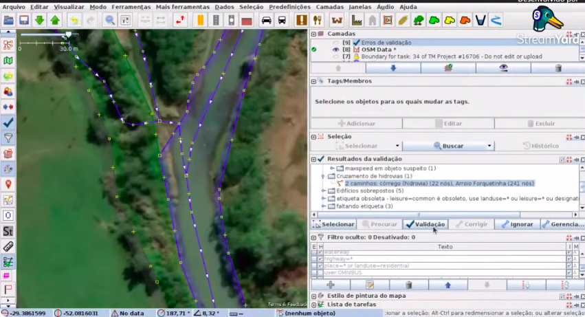
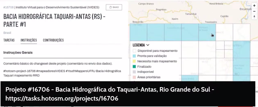
Oficina de mapeamento de feições importantes na redução de riscos de desastres (RRD) – YouthMappers UFRJ 2024-05-24 flag
OSMF Engineering Working Group meeting 2024-05-24

Note:
If you like to see your event here, please put it into the OSM calendar. Only data which is there, will appear in weeklyOSM.

This weeklyOSM was produced by SeverinGeo, Strubbl, TheSwavu, TrickyFoxy, YoViajo, adiatmad, barefootstache, derFred, euroPathfinder, miurahr, rtnf.
We welcome link suggestions for the next issue via this form and look forward to your contributions.